The research of physicists of St Petersburg University will enable climate change to be forecast more accurately.

Scientists of St Petersburg University are studying the water availability of clouds for modeling clouds in the subarctic in different seasons. New data obtained by physicists will make it possible to take an important step in solving the fundamental problem of studying climate change.
The project "Investigation of cloud water storage in the subarctic region of Russia on the basis of remote terrestrial and satellite measurements" is supported by a RFFR grant. The results have been published in a number of scientific journals including the Atmospheric Measurement Techniques and International Journal of Remote Sensing.
Cloud water is the factor that affects the entire atmospheric circulation, including weather, as well as the amount of fresh water in rivers and lakes, and the amount of snow cover and how long it lasts.
To accurately determine the water reserve of clouds in the subarctic region, including St Petersburg and the Leningrad Region, researchers at St Petersburg University have developed a special methodology. Scientists compare data on the water reserve of clouds, which is obtained remotely using various scientific instruments installed on satellites, with data on the surface of the Earth.
"Terrestrial and satellite devices use different technologies, and each method has its advantages and disadvantages. Thus, satellite measurements are carried out on a global scale, and measurements with a terrestrial microwave radiometer are only in a limited area but much more accurate. Comparing all the data, we will be able to introduce them into forecasting weather and climate models”, said Vladimir Kostsov, the head of the project, and leading research fellow at St Petersburg University and Doctor of Physical and Mathematical Sciences.
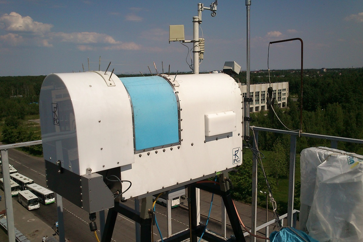
Scientists of St Petersburg University receive data on water storage of clouds from the European meteorological satellite, and measurements on the earth are carried out independently using a microwave radiometer RPG-HATPRO. The ground-based instrument, located at an altitude of 56 meters above sea level, is capable of 24-hour measurement. This radiometer differs from the satellite device SEVIRI, which uses reflected solar radiation for measurements and therefore provides information only during the day. Along with the water storage of clouds, the radiometer makes it possible to determine the whole complex of atmospheric parameters: vertical profiles of temperature; and pressure and air humidity up to an altitude of about 10 kilometers. This information is important for studying the evolution of cloudiness and in the analysis of both terrestrial and satellite data on water storage.
When comparing the data received from the radiometer and the satellite, a number of difficulties arise due to the difference in the technology of information collection. For example, in a few seconds of the so-called signal accumulation time, the receiving antenna of the radiometer, pointing upwards in the sky, gathers data on the water reserve within a radius of about 50 meters. At the same time, the satellite carries out this measurement on an area of about 50 square kilometers.
"We managed to cope with this difference, fixing the measurements of the radiometer for an hour - during this time the clouds that the satellite "saw", manage to fly over and above our device. Then we average the figures obtained by the ground method, and as a result we obtain data that is approximate to the satellite measurements," said Vladimir Kostsov.
Another problem that arises when comparing data is the radiometer location. The device is only three kilometers from the Gulf of Finland, where less clouds form over the water than over the land. This is due to the fact that moisture evaporates faster with the sun heated by the earth and rises upwards by convective currents. The problem is that the satellite "sees" a non-uniform cloud field, which complicates the process of comparing terrestrial and satellite measurements.
In addition to research challenges, scientists also encountered a different kind of problem: the radiometer became a favorite place for birds. The birds sat on the radio-transparent dome and pierced it with sharp beaks, which led to malfunctions.
"First, we hung a scarecrow on the radiometer, but it did not help. Then, we installed special anti-pricked thorns around the perimeter - birds see an obstacle to landing and fly by," said Vladimir Kostsov.
In the future, scientists plan to create an archive of data on the water reserve of clouds for the entire subarctic region. Now they are engaged in the primary analysis of measurement results, the elimination of failures and errors, and carrying out preliminary classification.
"The already verified data will allow a detailed study of the variability of the water reserve during various time scales - from a few minutes to daily and seasonal cycles. The work will be an important step for predicting climate change in the subarctic with the help of computer modeling, " said Vladimir Koscov, leading researcher at St Petersburg University.

